Loading…

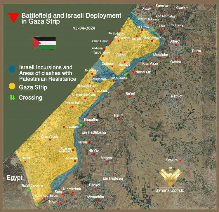
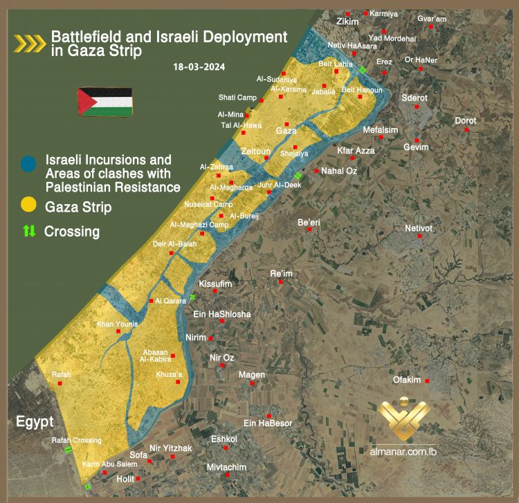
Al-Manar has prepared the following map showing the areas where Israeli occupation forces deploy now across the Gaza Strip.

The map, based on data obtained by Liveuamap mapping service provider, shows that the Israeli occupation forces are now stationed along the 1-kilometer deep path on the Gaza Strip’s border with the occupied territories in Gaza envelope, as well as the central area near Juhr Al-Deek in the east to the coast in the west, and the northern border of the besieged enclave.

Gaza Israeli deployment
Map that shows areas where IOF are stationed in Gaza on April 15. If we compare the map with the latest one prepared by Al-Manar last month (March 18), we can see total Israeli withdrawal from Salah Al-Din Road which links areas of Khan Younis, Al-Qarara, Al-Maghazi and Gaza city.

Course of the Isreli ground offensive in Gaza
Map showing deployment of IOF last March. To take a look into Al-Manar maps which show the course of the Israeli ground invasion of Gaza since October 27, click here.

Original Article Source: Al Manar | Published on Monday, 15 April 2024 12:10 (about 16 days ago)